
AUA Students Prepare Story Maps
3 min readYEREVAN, Armenia — American University of Armenia (AUA) students enrolled in adjunct lecturer Aghavni Harutyunyan’s General Education course Geographic Information Systems are leveraging cutting-edge technology to create dynamic and informative story maps. Using Geographic Information System (GIS) StoryMaps, an advanced digital storytelling platform, the students have developed interactive maps that seamlessly integrate narrative elements to illustrate spatial relationships and bring diverse stories to life.
These student projects cover a wide range of topics, from environmental conservation to cultural heritage. Each story map is a testament to their ability to blend GIS technology with compelling storytelling. By embedding rich narratives within their maps, the students can present complex data in an accessible and engaging manner, making their work not only informative, but also visually captivating.
Listed below are the students’ created maps, each accompanied by a description.
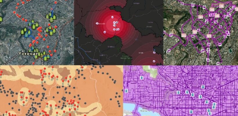
Author: Lilit Ivanyan (BSDS ’25)
The idea of the map came to me when my friends and I listened to a Russian song with these lyrics:
“Как мне описать то состояние в час, когда спешу я на свидание
Встретиться с тобой мне так не терпится, мысленно я время тороплю
В парке у пруда стою с букетом роз, вдруг ты не придёшь, и на душе мороз
Стройный силуэт я вижу издали, ветер треплет волосы твои.”
This part of the song describes the excitement of a man waiting for his woman in the park, near the pond, with a bouquet of flowers. I decided to create a map that points out some of the beautiful parks of Yerevan and the two closest flower stores to these parks to help gentlemen easily find bouquets of roses for their ladies while they rush to a date in the park.
Author: Gayane Abgaryan (BSESS ’27)
North Atlantic Right Whales are one of the most critically endangered marine mammals. As the abnormal mortality rate and inhibition of population growth are mainly due to anthropogenic factors such as vessel strikes, entrapment in fishing gear, and ocean noise, I wanted to perform analysis on the coastal areas where these whales are seen, observing their interaction with shipping areas, marine protected areas, and so on.
Author: Yanek Hayrapetyan (BSCS ’27)
The objective of this project is to find Armenian settlements that are supposedly most acutely affected by factories and mines, according to the map analysis, and conduct further research for each settlement to understand the number of people affected based on actual reports about the negative side effects of the factories and mines near these settlements.
Author: Luiza Grigoryan (BAB ’27)
The topic I have chosen is art museums and galleries. I decided to focus on art museums and galleries because they play a significant role in enriching communities and fostering cultural appreciation. Art has the power to teach, inspire, and connect people. By improving access to art museums and galleries, I believe we can promote cultural understanding and creativity, enhance quality of life, and make valuable contributions to society. Additionally, art museums often attract both locals and tourists; therefore, transportation and accessibility are very important. By addressing the challenge of navigating from bus stops to art museums, I aim to enhance the overall cultural experience for residents and all visitors. So, I wanted to ascertain the distance from bus stops to the nearest museum within walking distance (average speed = five km per hour) for a maximum of 25 minutes.
Author: Ruzanna Karamyan (BSDS ’26)
Understanding the extent of settlements within a four-km mudflow risk zone in Armenia holds paramount importance for both public safety and sustainable development initiatives. Armenia, with its diverse topography and geological composition, is prone to natural hazards such as mudflows, which pose significant threats to human life, infrastructure, and the environment. Identifying the number and distribution of settlements situated within this risk zone provides crucial insights for urban planning, disaster preparedness, and risk mitigation efforts. It enables policymakers, urban planners, and emergency responders to prioritize resources effectively, implement targeted interventions, and develop resilient infrastructure and land use policies to safeguard vulnerable communities. By addressing this issue proactively, Armenia can enhance its resilience to natural hazards, minimize potential losses, and foster sustainable development practices that prioritize the safety and wellbeing of its citizens.
Author: Monika Simonyan (BSCS ’27)
This project aims to tackle the unequal distribution of universities in Washington, D.C. Despite the city’s rich educational landscape, disparities exist, limiting access to higher education in certain areas. Meanwhile, I aim to showcase the high quality of education and aesthetic pleasure that one can obtain from attending these institutions. I am interested in this city’s education since some of its universities fall within the scope of those to which I am considering applying for graduate programs.
Founded in 1991, the American University of Armenia (AUA) is a private, independent university located in Yerevan, Armenia, affiliated with the University of California, and accredited by the WASC Senior College and University Commission in the United States. AUA provides local and international students with Western-style education through top-quality undergraduate and graduate degree and certificate programs, promotes research and innovation, encourages civic engagement and community service, and fosters democratic values.